

Preview
Creation Date
1834
Description
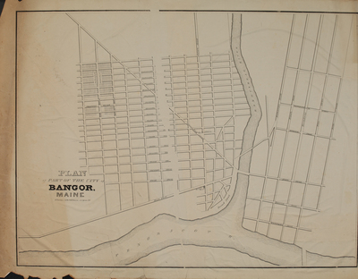
This map, titled Plan of Part of the City of Bangor, Maine was published sometime shortly after 1834, as it shows the Bangor House. It was published by N. Curriers Lith[ographers], 148 Nassau cor.Spruce, N.Y. As this differs considerably from the other maps of Bangor this might be a proposed plan. Note that "New York Park" is roughly in the Fairmount area of the city. Attached to the Zadoc french plan.
Size
74.8 cm x 56 cm
Document Type
Map
To view larger size: Download and view in your browser
Keywords
Bangor, proposed plan
Image Location
Rights Statement

No Copyright - United States. URI: http://rightsstatements.org/vocab/NoC-US/1.0/
The organization that has made the Item available believes that the Item is in the Public Domain under the laws of the United States, but a determination was not made as to its copyright status under the copyright laws of other countries. The Item may not be in the Public Domain under the laws of other countries. Please refer to the organization that has made the Item available for more information.