

Preview
Creation Date
1853
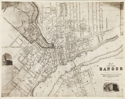
Description
This is taken from a photographic reproduction of a wall size map. This is a Map of the City of Bangor Penobscot County Maine published under the patronage of the city government. Created by Henry F. Walling, civil engineer, 81 Washington Street, Boston, 1853. Published by S.S.Smith, 17 West Market Square, Bangor.
Scale
33.7 feet to the inch (on original)
Size
28 cm x 35.5 cm (copy)
Document Type
Map
To view larger size: Download and view in your browser
Keywords
Bangor
Image Location
Rights Statement

No Copyright - United States. URI: http://rightsstatements.org/vocab/NoC-US/1.0/
The organization that has made the Item available believes that the Item is in the Public Domain under the laws of the United States, but a determination was not made as to its copyright status under the copyright laws of other countries. The Item may not be in the Public Domain under the laws of other countries. Please refer to the organization that has made the Item available for more information.